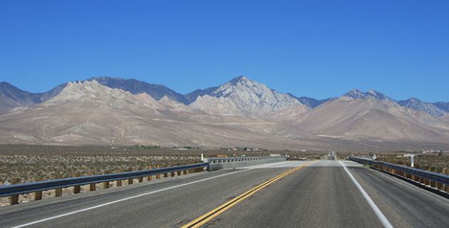
“Variety” may as well be California’s middle name. From barren deserts to lush mountains to sparkling beaches, the state truly has it all—and you can see it all on U.S. Route 395.
It’s a burly road trip for the brave; its sights severe, its offerings adventurous. The highway will take you from the country’s lowest point to its highest peak—and that’s just in the first 100 miles.
All told, California’s stretch of the interstate—whose complete course runs from the Mojave Desert to the Canadian border at British Columbia—clocks in at about 360 miles. The route lies east of the mighty Sierra Nevada, placing it on the wrong side of California’s spectacular ocean views, but insulating it from easy commercialization by the tourist industry. And the alpine environment offers plenty of extreme beauty, much of which, thanks to the road’s under-the-radar status, has been fully maintained.
Just like California itself, the strip of road brims with possibilities, a nearly endless number of oddball pit stops and optional day trips making each journey up the 395 unique.
Still, there are a few boldface stops that any trip along the highway should include.
Death Valley National Park
What better place to start than the bottom? (At least from there, you can only work your way up—and on this trip, you assuredly will.)
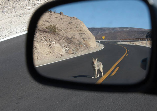
Death Valley is not only the country’s lowest point, it’s also the continent’s driest area—and the planet’s hottest locale. (Current world record: 134 degrees Fahrenheit, recorded at the park’s Furnace Creek in 1913.) It’s located about 100 miles east of Route 395—you can hop off on California Highways 136 or 190 to access the park.
The extreme nature of the national park should warrant precaution when planning a trip there—it’s probably best to stay away in the summer months altogether—but the area rewards courageous (and prepared) travelers with striking desert views, and a true sense of solitude.
A number of hiking paths crisscross the expansive park, ranging from easy to difficult, to appease wanderers of all risk-taking sensibilities. If you enjoy the peace and pace of desert life, camping is available to extend your stay in the area.
But gulp down all the fresh oxygen you can before leaving the basin—because you’re about to shoot toward the stratosphere.
Lone Pine, CA
Whatever else you decide to bring on your 395 journey, make sure to pack some gum. You’re going to be gaining some serious altitude. (Chewing helps with the pressure.)
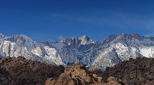
The 100-mile drive from Death Valley to Lone Pine takes just under 2 hours but covers about 4,000 vertical feet—sending you just shy of a mile up into the air, and placing you at the doorstep of the highest peak in the continental United States.
The town is small but makes a great home base from which to explore the area’s fantastic soaring sights, including all 14,508 ft. of Mount Whitney, the country’s tallest mountain outside of Alaska. The state is especially protective of the peak, so you’ll need a special permit to climb much farther than base camp, but even the drive along Whitney Portal Road to reach the campgrounds at the foot of the mountain includes a stretch of breathtaking panoramas.
Lone Pine offers easy access to a number of other Sierra peaks as well and is also close to the Alabama Hills, a shorter but equally spectacular range that houses its own fair share of natural wonders, like the Mobius Arch.
And if Mother Nature doesn’t cooperate weather-wise, you can spend a rainy day inside the nearby Museum of Western Film History and learn about the mind-boggling number of movies that used the area as a backdrop.
You may have reached the highway’s high point, but you’ve far from exhausted its highlights, with more than 250 miles of peaks ahead.
Mammoth Lakes, CA
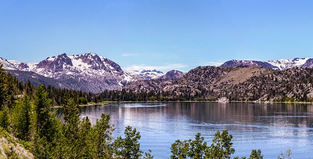
Pushing northward, deeper into the High Sierra, the road is enveloped and elevated by the mountains. After 100 miles and about 4,100 more vertical feet, you’ll reach Mammoth Lakes, an active town in the heart of the range with access to a number of recreational expanses, including Mammoth Mountain.
The outdoor wonderland is busy year-round, with available activities ranging from winter skiing to spring fishing to summer hiking to fall camping. But no matter what time of year you visit, the day’s high-energy activities can be melted away with a trip to several nearby hot springs, including Hot Creek.
The town is also just a short trip down Route 395 from one of the country’s most celebrated national parks: Yosemite.
Yosemite National Park
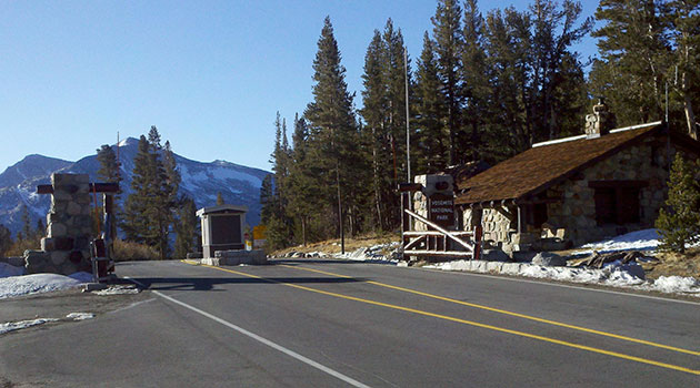
The famous national park is just 40 miles north of Mammoth Lakes, ensconced by fantastic swoops of High Sierra granite.
The breathtaking valley is well known for its waterfalls, but also features Alpine meadows, ancient sequoias, and rugged wilderness. Backpackers and day hikers alike can trek any number of trails leading to some of the area’s most coveted views, including Half Dome and El Capitan.
In the summer, you can ride 395 to Tioga Pass, a lesser-traveled route that takes the back way into Yosemite Valley, climbing nearly 6,000 vertical feet in the process and offering access to vistas that would impress even Ansel Adams.
And 395 isn’t out of steam yet.
Lake Tahoe
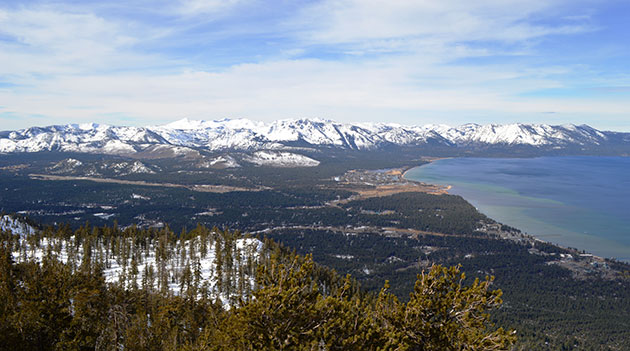
The mountainous views continue about another 120 miles north along the highway (which passes into Nevada) until you reach the venerable outdoor playground of Lake Tahoe, another destination thriving in the thin air of high peaks.
Available activities depend on the time of year, but there’s always something recreational to delve into, from swimming, boating, fishing, or paddle-boarding along the massive freshwater lake to hiking, biking, and climbing in the mountains surrounding it. Winter welcomes skiing, snowboarding, and other cold-weather activities, while fall brings with it the majesty of autumn-colored leaves on aspens. The clutch of towns surrounding the lake offer a warm welcome no matter when you visit, making the area a great place to rest and plan your next adventure.
Bonus Stops
Route 395 may stretch about 400 miles through California, but the sights it offers are nearly incalculable.
Whether you want to wander more deeply into the wilderness, reflect more deeply on society, or indulge yourself after a rugged go, you’ll find many experiences waiting for you along the road.
Manzanar
If you’re a history buff as well as an outdoor type, make sure to make time to visit this site, just 11 miles north of Lone Pine.
In the 1940s, Manzanar War Relocation Center housed thousands of Japanese-Americans who were ordered to leave their homes on the West Coast at the height of World War II. Today, the rebuilt site remains as a museum—and a poignant reminder of a troubled time in our nation’s not-too-distant past.
Ancient Bristlecone Pine Forest
Taking a short detour about halfway between Lone Pine and Mammoth—and about a half hour east off the 395—will bring you to yet another landscape unique to California: the Ancient Bristlecone Pine Forest. Populated by strange, twisted trees—some of which exceed 4,000 years old—this original environment is part moonscape-part dreamscape, and home to a number of hikes and campgrounds.
Devil's Postpile National Monument & Rainbow Falls
About a half-hour east of Mammoth’s main ski resort, a geological anomaly stands: the strange 60-foot-tall vertical formation of the Devil’s Postpile and the spectacular 101-foot drop of Rainbow Falls.
The natural wonders are typically only reachable in the summer, but undoubtedly worth the wait.
Lassen National Park
A fine—and underrated—example of the beauty volcanic activity can wreak, Lassen National Park is located about 150 miles north of Tahoe, and is home to Alpine meadows, rugged peaks, wildflower fields, and a number of areas where Earth is still actively smoldering.
Reno, NV
If you’re ready to move the party indoors, keep driving about another half hour north of Tahoe until you see the lights of Reno, Nevada, the Biggest Little City in the World. The bawdy town offers all the neon lights and nightlife you left far behind in the mountains, and all the creature comforts you may have been missing.